MAKE A MEME
View Large Image
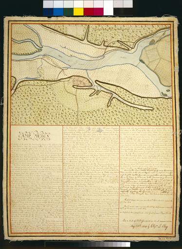
| View Original: | Ketch map of Camp Meigs by Eliza Clay, 1814.jpg (5600x7664) | |||
| Download: | Original | Medium | Small | Thumb |
| Courtesy of: | commons.wikimedia.org | More Like This | ||
| Keywords: Ketch map of Camp Meigs by Eliza Clay, 1814.jpg LargeImage ketch map of Camp Meigs on the Miami River at Lake Erie Includes handwritten account of the defending forces during the sieges of the camp which began May 9 1813 and July 21 1813 The commanding officers at Camp Meigs were Major General Harrison and General Green Clay father of Eliza L Clay who commanded a detachment of 1200 men from Kentucky This map was probably derived from a map drawn by Joseph H Larwill a Lieutenant in Cushing's Company of the Second Regiment of Artillery He surveyed the area on July 19 1813 Scale 1 inch 220 yards Kentucky Historical Society Map Collection 1814 Clay Eliza PD-old http //www kyhistory com/cdm/compoundobject/collection/Maps/id/224/rec/1 Fort Meigs 1814 maps | ||||