MAKE A MEME
View Large Image
| View Original: | Katrina Path.png (770x641) | |||
| Download: | Original | Medium | Small | Thumb |
| Courtesy of: | commons.wikimedia.org | More Like This | ||
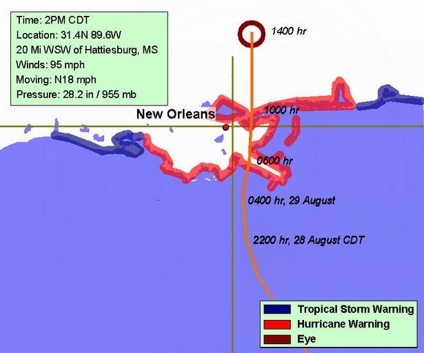
| Keywords: Katrina Path.png Hurricane Katrina Track is based on various sources including National Weather Service National Hurricane Centre and WWLTV radar image The latest information is based on The Weather Channel Hurricane Katrina maps 2005-08-29 own assumed Vsion | ||||