MAKE A MEME
View Large Image
| View Original: | KAARTEN SGD - Deltaplan.jpeg (1115x1582) | |||
| Download: | Original | Medium | Small | Thumb |
| Courtesy of: | commons.wikimedia.org | More Like This | ||
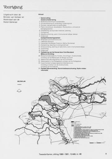
| Keywords: KAARTEN SGD - Deltaplan.jpeg accession number en The individual creators of this map are unknown it was commissioned by the House of Representatives of the Netherlands Op de kaart zijn tevens de plaatsen aangegeven waar dijkverhoging dient te gaan geschieden Voorts is de toekomstige zout- en zoetwatersituatie van diverse wateren aangeduid Behoort bij de achtste Voortgangsrapportage Oosterschelde periode januari-juni 1980 help warp This map was digitized by the Institution Koninklijke Bibliotheek ; Koninklijke Bibliotheek 51 5833333333334 Deltagebied 4 29166666666667 map date 1980 civieltechnische werken weg- en waterbouw other fields other versions CC0 print date 1980 This map was commissioned and published by the Institution Tweede Kamer ca 1 800 000 This image in context http //www statengeneraaldigitaal nl/document id sgd mpeg21 19801981 0002017 pagina 4; Tweede Kamer KAARTEN SGD - Deltaplan wikidata location wikidata title Uploaded with GWToolset KAARTEN SGD - Deltaplan http //resolver kb nl/resolve urn sgd mpeg21 19801981 0002017 0004 image Eastern Scheldt Maps of Zeeland Delta Works Western Scheldt | ||||