MAKE A MEME
View Large Image
| View Original: | John_E._Weyss06.jpg (900x762) | |||
| Download: | Original | Medium | Small | Thumb |
| Courtesy of: | commons.wikimedia.org | More Like This | ||
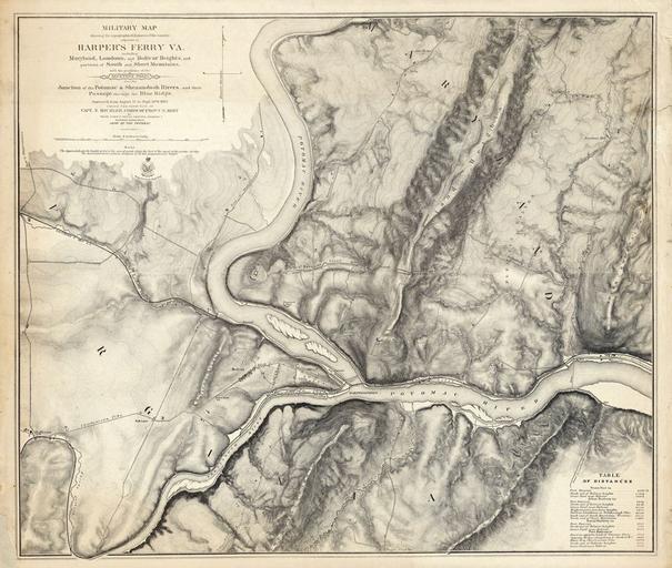
| Keywords: John E. Weyss06.jpg en Military map showing the topography of the country around Harper's Ferry Va including Maryland Loudoun and Bolivar Heights and portions of South and Short Mountains with the positions of the Defensive Works also the Junction of the Potomac Shenandoah Rivers and their passage through the Blue Ridge Surveyed from 3 August to 30 September 1863 under the direction of Capt N Michler Corps of Engrs U S Army By Major John E Weyss Principal Assistant Engineer Department Army Of The Potomac http //www historynyc com/proddetail asp prod 3874000 John E Weyss 1820-1903 1863 John E Weyss Harpers Ferry West Virginia Old maps of the American Civil War PD-old-100 | ||||