MAKE A MEME
View Large Image
| View Original: | IMG_3076.jpg (5184x3456) | |||
| Download: | Original | Medium | Small | Thumb |
| Courtesy of: | www.flickr.com | More Like This | ||
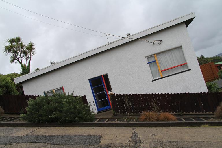
| Keywords: outdoor architecture building Baldwin Street, in Dunedin, New Zealand is the world's steepest residential street, according to the Guinness Book of World Records. It is located in the residential suburb of North East Valley, 3.5 kilometres (2.2 mi) northeast of Dunedin's city centre. A short straight street a little under 350 metres (1,150 ft) long, Baldwin Street runs east from the valley of the Lindsay Creek up the side of Signal Hill towards Opoho, rising from 30 m (98 ft) above sea level at its junction with North Road to 100 m (330 ft) above sea level at the top, an average slope of slightly more than 1:5. Its lower reaches are only moderately steep, and the surface is asphalt, but the upper reaches of this cul-de-sac are far steeper, and surfaced in concrete (200 m or 660 ft long), for ease of maintenance (bitumen—in either chip seal or asphalt—would flow down the slope on a warm day) and for safety in Dunedin's frosty winters. The 161.2 metres (529 ft) long top section climbs 47.2 metres (155 ft) vertically, an average gradient of 1:3.41. At its maximum, about 70 metres (230 ft) below the top,[3] the slope of Baldwin Street is about 1:2.86 (19° or 35%). That is, for every 2.86 metres travelled horizontally, the elevation changes by 1 metre. en.wikipedia.org/wiki/Baldwin_Street Baldwin Street, in Dunedin, New Zealand is the world's steepest residential street, according to the Guinness Book of World Records. It is located in the residential suburb of North East Valley, 3.5 kilometres (2.2 mi) northeast of Dunedin's city centre. A short straight street a little under 350 metres (1,150 ft) long, Baldwin Street runs east from the valley of the Lindsay Creek up the side of Signal Hill towards Opoho, rising from 30 m (98 ft) above sea level at its junction with North Road to 100 m (330 ft) above sea level at the top, an average slope of slightly more than 1:5. Its lower reaches are only moderately steep, and the surface is asphalt, but the upper reaches of this cul-de-sac are far steeper, and surfaced in concrete (200 m or 660 ft long), for ease of maintenance (bitumen—in either chip seal or asphalt—would flow down the slope on a warm day) and for safety in Dunedin's frosty winters. The 161.2 metres (529 ft) long top section climbs 47.2 metres (155 ft) vertically, an average gradient of 1:3.41. At its maximum, about 70 metres (230 ft) below the top,[3] the slope of Baldwin Street is about 1:2.86 (19° or 35%). That is, for every 2.86 metres travelled horizontally, the elevation changes by 1 metre. en.wikipedia.org/wiki/Baldwin_Street | ||||