MAKE A MEME
View Large Image
| View Original: | Illyricum & Dacia - AD 400.png (971x673) | |||
| Download: | Original | Medium | Small | Thumb |
| Courtesy of: | commons.wikimedia.org | More Like This | ||
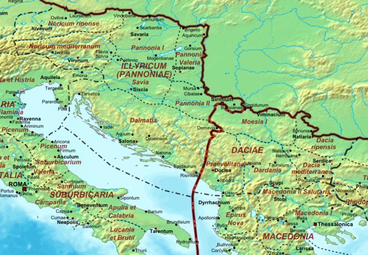
| Keywords: Illyricum & Dacia - AD 400.png Map of the Roman Empire ca 400 AD showing the administrative division into dioceses and provinces as well as the major cities The demarcation between Eastern and Western Empires is noted in red The_Roman_Empire_ca_400_AD png 50 2013-12-22 21 22 UTC The_Roman_Empire_ca_400_AD png Cplakidas derivative work Jbribeiro1 Illyricum and Dacia Jbribeiro1 The_Roman_Empire_ca_400_AD png Maps of Roman provinces Maps of the Byzantine Empire Maps of the Western Roman Empire Maps of Europe in the 4th century Notitia Dignitatum Maps of Illyricum Maps of Dacia Maps of Pannonia | ||||