MAKE A MEME
View Large Image
| View Original: | Illinois flooding disaster areas, April 2013.png (298x494) | |||
| Download: | Original | Medium | Small | Thumb |
| Courtesy of: | commons.wikimedia.org | More Like This | ||
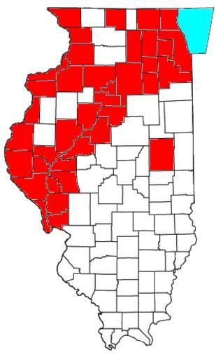
| Keywords: Illinois flooding disaster areas, April 2013.png Map showing Illinois counties declared disaster areas as a result of flooding in April 2013 as of the morning of 19 April Map taken from http //www2 census gov/geo/maps/general_ref/cousub_outline/cen2k_pgsz/oh_cosub pdf here; information taken from http //newstrib com/main asp SectionID 2 SubSectionID 27 ArticleID 28305 here; map is an own 2013-04-21 User Nyttend Nyttend 2013 floods Floods in Illinois Maps of floods Maps of the history of Illinois Maps by User Nyttend Maps of weather in 2013 0421 | ||||