MAKE A MEME
View Large Image
| View Original: | Huron(1).jpg (2641x2498) | |||
| Download: | Original | Medium | Small | Thumb |
| Courtesy of: | commons.wikimedia.org | More Like This | ||
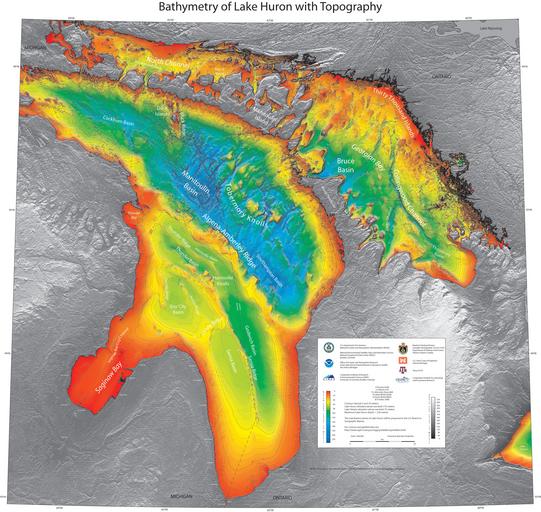
| Keywords: Huron(1).jpg en Annotated Bathymetry Map of Lake Huron showing subsurface ridges labelled This image is necessary to show ridge areas under water and under research 2016-09-07 NOAA National Centers For Environmental Information National Oceanic and Atmospheric Administration by Right of the United States of America other versions PD-USGov Great Lakes | ||||
.jpg)