MAKE A MEME
View Large Image
| View Original: | Hungarian autonomous province02.png (751x727) | |||
| Download: | Original | Medium | Small | Thumb |
| Courtesy of: | commons.wikimedia.org | More Like This | ||
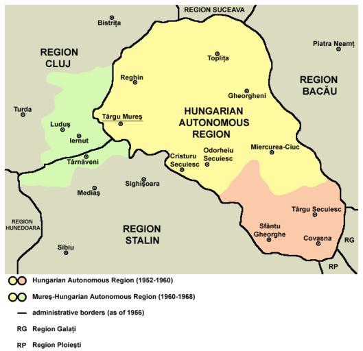
| Keywords: Hungarian autonomous province02.png Map of the Hungarian Autonomous Region / Magyar Autonomous Region 1952-1960 and Mureş-Hungarian Autonomous Region / Mureş-Magyar Autonomous Region 1960-1968 2006 Transferred from en wikipedia PANONIAN en PANONIAN References Primary reference http //terkepek adatbank transindex ro/kepek/netre/261 gif Secondary references http //www adevarul ro/bbtcontent/clipping/ADVIMA20110612_0443/1 jpg http //www hungarian-human-rights eu/images/rpr_1952 jpg http //sebok1 adatbank transindex ro/kepek/erd1956 jpg http //sebok1 adatbank transindex ro/kepek/erd1966 jpg http //2 bp blogspot com/_yYcDY0o6YEA/SXaL1dSAXGI/AAAAAAAAAFk/21nu4zMSKJ8/s600/RO1960-1968 jpg Maps of the history of modern Romania Maps of the history of Transylvania Magyar Autonomous Region Maps of Székely Land | ||||