MAKE A MEME
View Large Image
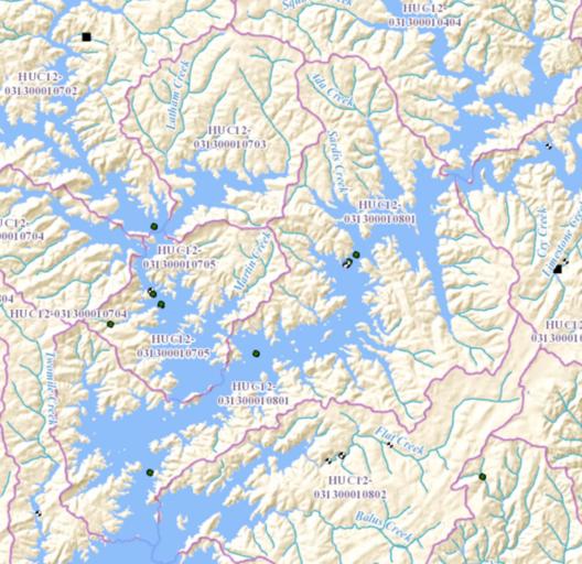
| View Original: | HUC 031300010801 - Upper Lake Sidney Lanier.tiff (1152x1118) | |||
| Download: | Original | Medium | Small | Thumb |
| Courtesy of: | commons.wikimedia.org | More Like This | ||
| Keywords: HUC 031300010801 - Upper Lake Sidney Lanier.tiff en HUC 031300010801 - Map shows the Upper Lake Lanier area which includes parts of the Chestatee River and Chattahoochee River arms of the lake 2016-01-12 http //viewer nationalmap gov/viewer/nhd html p nhd b base1 q 031300010801 x -9334890 7448524 y 4071617 6007313896 l 12 v USGS other versions PD-USGov Geography of the United States Hydrology in the United States Basins of the United States Hydrologic Unit Code maps of the United States United States Geological Survey maps | ||||