MAKE A MEME
View Large Image
| View Original: | Hawaii-counties-map.gif (629x351) | |||
| Download: | Original | Medium | Small | Thumb |
| Courtesy of: | commons.wikimedia.org | More Like This | ||
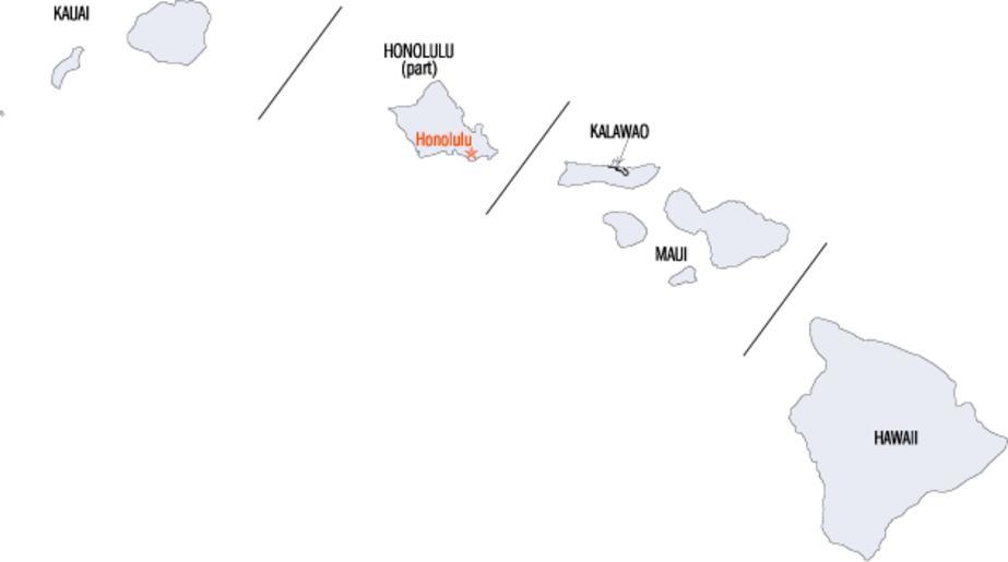
| Keywords: Hawaii-counties-map.gif locator map Map showing five counties of Hawaii http //www fedstats gov/qf/maps/stout15 gif decade 2000 http //www fedstats gov/ FedStats This is an original work by the United States Federal Government thus it belongs to public domain PD-USGov page was on en wikipedia http //en wikipedia org/w/index php title Special Log page File Hawaii-counties-map gif file log All following user names refer to en wikipedia 02 56 14 May 2007 UTC Gracenotes 629×351 7 KB crop image 23 31 10 December 2004 UTC Jengod 660×692 7 KB <nowiki> PD-USGov SOURCE http //www fedstats gov/qf/maps/stout15 gif Category Hawaii maps </nowiki> Maps of counties of Hawaii | ||||