MAKE A MEME
View Large Image
| View Original: | Halsey_Old_NY_Frontier_Patent_Map.png (4589x4071) | |||
| Download: | Original | Medium | Small | Thumb |
| Courtesy of: | commons.wikimedia.org | More Like This | ||
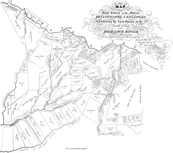
| Keywords: Halsey Old NY Frontier Patent Map.png Map of the Head Waters of the Rivers Susquehanna and Deleware Embracing the Early Patents on the South Side of the Mohawk River From the orignal drawn about the year 1790 by Simeon Dewitt Esq Surveyor General c State of New York with the date of each Patent now appended from the Rec in Survey'r Gen'l's Office By EBOC A foldout map in The Old New York Frontier by Francis Whiting Halsey published in 1901 Scanned by me from The Old New York Frontier 1790 Simeon Dewitt PD-old-100 s Image Old NY Frontier Patent Map png 2 x this one and Image Halsey Old NY Frontier Patent Map small png 1/2 x this one <br> Note Because of their large size this and the higher resolution image on WikiSource will no longer render in articles where they are used The small version shows up fairly well when reduced for an article but small details cannot all be be easily read when it's enlarged -- to see these view either this image or the larger version on WikiSource Old maps of New York Maps by Simeon De Witt Images by R A Nonenmacher Maps The Old New York Frontier | ||||