MAKE A MEME
View Large Image
| View Original: | GreysRaid.png (3648x2695) | |||
| Download: | Original | Medium | Small | Thumb |
| Courtesy of: | commons.wikimedia.org | More Like This | ||
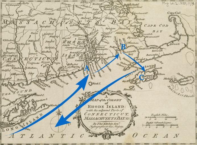
| Keywords: GreysRaid.png A 1778 map annotated with the route of a raiding expedition against Massachusetts coastal communities in September 1778 The expedition was under the command of British General Charles Grey Points of note A Newport Rhode Island B New Bedford and Fairhaven Massachusetts C Martha's Vineyard Boston Public Library Online Maps Collection http //maps bpl org/details_14154/ base image 1778; annotation 2011 base image Thomas Kitchin; annotation User Magicpiano public domain Conflicts in 1778 Old maps of the American Revolution Old maps of Massachusetts Old maps of Rhode Island Battles of the American Revolutionary War Thomas Kitchin Newport Rhode Island in the 18th century Rhode Island in the 1770s PD-Art | ||||