MAKE A MEME
View Large Image

| View Original: | Great_Lakes_(metric_DE).svg (1000x398) | |||
| Download: | Original | Medium | Small | Thumb |
| Courtesy of: | commons.wikimedia.org | More Like This | ||
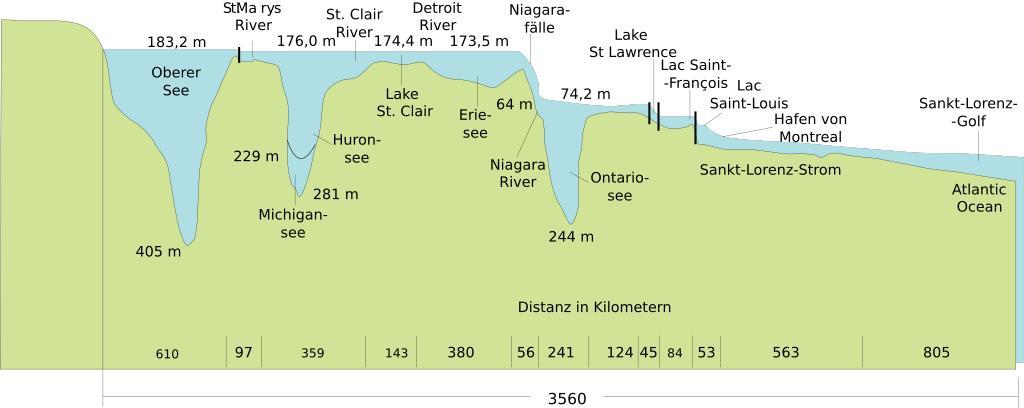
| Keywords: Great Lakes (metric DE).svg en The figure shows typical water surface elevations and comparative lake depths of the Great Lakes with geographic Names in German and dimensions in the metric system de Die Abbildung zeigt die typischen Höhenangaben der Wasseroberflächen und vergleichsweise Wassertiefen der Großen Seen 2014-11-29 Great Lakes svg 50 Great Lakes svg U S Army Corps of Engineers Detroit District derivative work Hazmat2 other fields A 0 - + Maps edited with Inkscape clr PD-USGov Uploaded with UploadWizard Great Lakes Saint Lawrence River Basin | ||||