MAKE A MEME
View Large Image
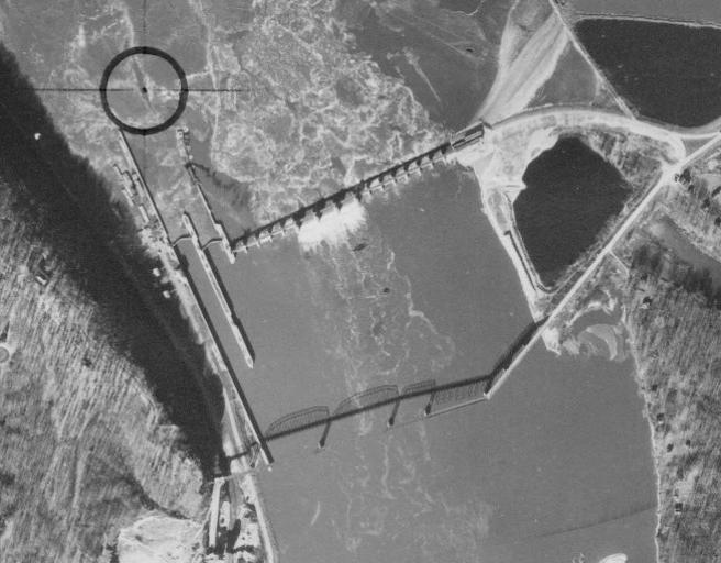
| View Original: | Grant11171940_11A-73_7x9_crop_Lock_and_Dam_11_with_Eagle_Point_Bridge.jpg (653x510) | |||
| Download: | Original | Medium | Small | Thumb |
| Courtesy of: | commons.wikimedia.org | More Like This | ||
| Keywords: Grant11171940 11A-73 7x9 crop Lock and Dam 11 with Eagle Point Bridge.jpg Lock and Dam No 11 Upper Mississippi River Mississippi River Lock and Dam No 11 with the Eagle Point Bridge near Dubuque in Dubuque County Iowa and Grant County Wisconsin ;Photograph Agency Source Information Agency USDA Subject Water Roll-Exp 11A-73 11/17/1940 The source agencies responsible for the original flights are the United States Department of Agriculture USDA and the United States Geological Survey USGS The vast majority of the state was flown by the USDA Only parts of Forest Florence Iron Marinette Oneida and Vilas counties were flown by the USGS Photograph Information Format The original aerial photographs are black and white They measure either a seven inches by nine inches 7 x9 or b nine inches by nine inches 9 x9 Scale All photographs in the 1937-41 series are 1 20 000 or 1 1667 ™ Copyright As works of the United States government all photographs in this collection are in the public domain http //maps sco wisc edu/WHAIFinder/ USDA 1940-11-17 Lock and Dam No 11 Upper Mississippi River 02 Mississippi River in Iowa Eagle Point Bridge Bridges in Iowa Eagle Point Bridge Buildings in Dubuque County Iowa Mississippi Grant County Wisconsin Mississippi 1940 in Iowa PD-USGov | ||||