MAKE A MEME
View Large Image
| View Original: | GOES-13_2_Jan_2014_1745z_satellite.png (1920x1080) | |||
| Download: | Original | Medium | Small | Thumb |
| Courtesy of: | commons.wikimedia.org | More Like This | ||
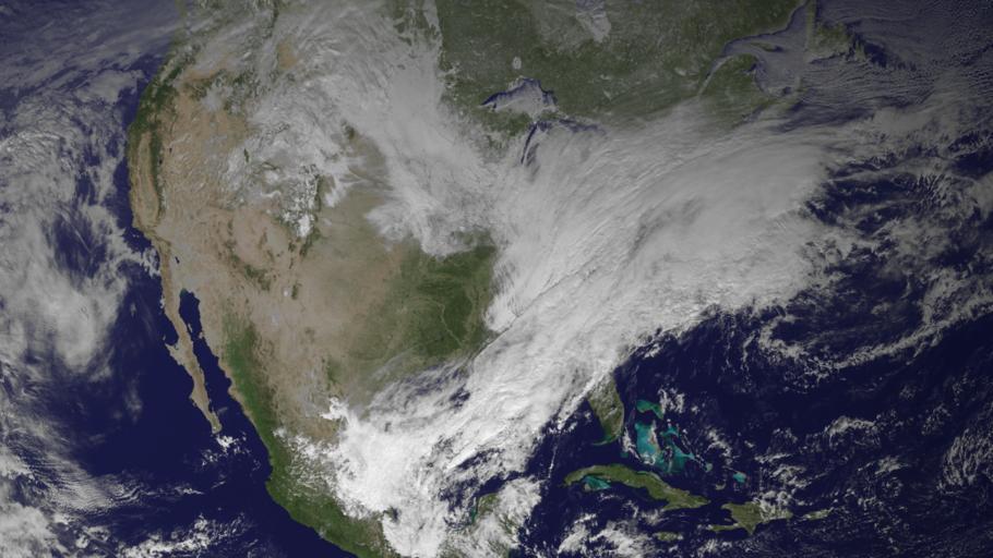
| Keywords: GOES-13 2 Jan 2014 1745z satellite.png en A GOES-13 satellite image captured at 17 45 UTC on January 2 2014 depicting an ongoing blizzard across portions of the Ohio River Valley and the Northeast United States as cold air from Canada moves across warm air from the Gulf of Mexico 2014-01-08 00 31 29 http //www nnvl noaa gov/images/high_resolution/1478v1_20140102-GOES-Blizzard png National Oceanic and Atmospheric Administration PD-USGov Uploaded with UploadWizard 2013 “14 North American cold wave Maps of weather in 2014 01021745 Cold front Satellite pictures of mid-latitude storms 201401011745 | ||||