MAKE A MEME
View Large Image

| View Original: | Giovanni_Antonio_Magini._Moscoviae_Imperivm._1608.jpg (4656x3571) | |||
| Download: | Original | Medium | Small | Thumb |
| Courtesy of: | commons.wikimedia.org | More Like This | ||
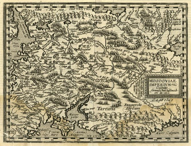
| Keywords: Giovanni Antonio Magini. Moscoviae Imperivm. 1608.jpg la Moscoviae Imperivm en The map of Muscovite Empire includes also the territory of old Livonia and the North-eastern part of the Baltic Sea The map depicts the end of the 16th century the beginning of the 17th century cartographers notion of the Baltic Sea coastlines geographic view which is of interest to us Even though in the territory of present-day Latvia only a few place-names are noted Riga Venda Dunemborg Duina fluu and Cureti pop and the coastline is significantly misrepresented the map is testimony to the increasing geographical knowledge in Europe about our land The map is included in M Quad s atlas published in Cologne in 1608 This map is a copy of G A Magini s map of Moscowy which was first published in the 1596 edition of Claudius Ptolemy s Geography lt Å ajÄ Maskavijas kartÄ ietverta arÄ« senÄs Livonijas teritorija un ZA daļa no Baltijas jÅ«ras kas kartÄ uzrÄdÄ«ta kÄ Livonijas jÅ«ra Karte interesanata ar ilustratÄ«vo mežu un kalnu atveidojumu Kaut gan mÅ«sdienu Latvijas teritorijÄ ir atzÄ«mÄti tikai daži vietvÄrdi Riga Venda Dunemborg Duina fluu Cureti pop un krastu lÄ«nija ir gaužÄm sagrozÄ«ta tomÄr tÄ ir liecinÄjums par Ä£eogrÄfisko zinÄÅ¡anu attÄ«stÄ«bu EiropÄ par mÅ«su zemi Karte ietverta 1608 g ĶelnÄ iznÄkuÅ¡ajÄ M Kuada atlantÄ http //www theeuropeanlibrary org/exhibition-travel-history/detail html id 167291 www theeuropeanlibrary org 1608 Giovanni Antonio Magini Old maps of Tsardom of Russia 1608 maps Maps by Giovanni Antonio Magini Old maps of Ukraine Maps of Livonia PD-Art-100 | ||||