MAKE A MEME
View Large Image
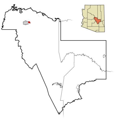
| View Original: | Gila County Incorporated and Unincorporated areas Star Valley highlighted.png (564x599) | |||
| Download: | Original | Medium | Small | Thumb |
| Courtesy of: | commons.wikimedia.org | More Like This | ||
| Keywords: Gila County Incorporated and Unincorporated areas Star Valley highlighted.png locator map This map shows the incorporated areas and unincorporated areas in Gila County Arizona Star Valley is highlighted in red Incorporated cities are shown in gray and unincorporated communities or CDPs are shown in white Data for the borders and locations are based on maps from the http //tiger census gov/cgi-bin/mapbrowse-tbl US Census Bureau TIGER Map Server and the http //www starvalley-az gov/ Star Valley municipal website Own Node ue Maps of Gila County | ||||