MAKE A MEME
View Large Image
| View Original: | German sw africa map.png (2000x2000) | |||
| Download: | Original | Medium | Small | Thumb |
| Courtesy of: | commons.wikimedia.org | More Like This | ||
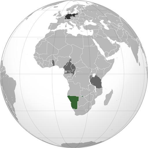
| Keywords: German sw africa map.png Green Territory comprising German colony of German South-West Africa<br>Dark gray Other German possessions<br>Darkest gray German Empire Note The map uses the borders of the present-day but the historical extent for German territories are depicted thumb 2010-06-02 VoodooIsland wikipedia en VoodooIsland Original upload log en wikipedia Misha motsniy CommonsHelper en wikipedia German+sw+africa+map png 2010-06-02 20 52 VoodooIsland 2000×2000× 609830 bytes 2010-06-02 20 50 VoodooIsland 2000×2000× 609907 bytes 2010-06-02 20 49 VoodooIsland 2000×2000× 609725 bytes <nowiki>Green Territory comprising German colony of German South-Wesy Africa<br>Dark gray Other German possessions<br>Darkest gray German Empire Note The map uses the borders of the present-day but the </nowiki> Maps with orthographic projection German South-West Africa | ||||