MAKE A MEME
View Large Image
| View Original: | German Submarine Zone February 1915 after Reynolds et al.jpg (1273x1651) | |||
| Download: | Original | Medium | Small | Thumb |
| Courtesy of: | commons.wikimedia.org | More Like This | ||
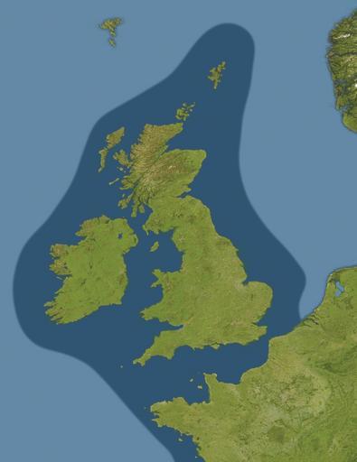
| Keywords: German Submarine Zone February 1915 after Reynolds et al.jpg Map showing submarine warfare zone around the United Kingdom declared by Germany on February 18 1915 German_Submarine_Zone_February_1915_SGW_Vol_V png Europe_satellite_image_location_map jpg 2009-03-10 17 34 UTC German_Submarine_Zone_February_1915_SGW_Vol_V png artist not identified Europe_satellite_image_location_map jpg NordNordWest derivative work Bellhalla <span class signature-talk >talk</span> Quadratische Plattkarte N-S-Streckung 150 Geographische Begrenzung der Karte N 74° N S 34° N W 25° W O 60° O e</nowiki> Uploaded with derivativeFX Atlantic theatre of World War I Naval warfare maps of World War I North Sea theatre of World War I World War I submarine warfare | ||||