MAKE A MEME
View Large Image

| View Original: | GDOT_Freight_Mobility_GRIP_Plans.jpg (5400x6600) | |||
| Download: | Original | Medium | Small | Thumb |
| Courtesy of: | www.flickr.com | More Like This | ||
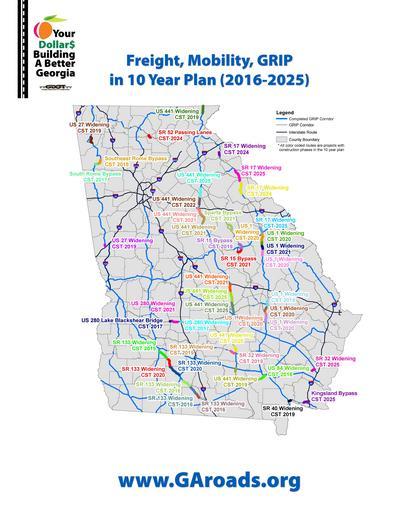
| Keywords: drawing illustration map This is map showing GDOT's investments over the next ten years when it comes to the GRIP corridors. The GRIP program started in the late 1980s and it intended to make sure that 90 percent of Georgia's population is within 20 miles of a 4-lane highway. This is map showing GDOT's investments over the next ten years when it comes to the GRIP corridors. The GRIP program started in the late 1980s and it intended to make sure that 90 percent of Georgia's population is within 20 miles of a 4-lane highway. | ||||