MAKE A MEME
View Large Image

| View Original: | G-F_triangulation.jpg (272x400) | |||
| Download: | Original | Medium | Small | Thumb |
| Courtesy of: | commons.wikimedia.org | More Like This | ||
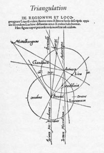
| Keywords: G-F triangulation.jpg Gemma Frisius's 1533 diagram introducing the idea of triangulation into the science of surveying Having established a baseline eg the cities of Brussels and Antwerp the location of other cities eg Middelburg can be found by taking its compass direction at each end of the baseline and plotting where the two directions cross Note that this was only a theoretical presentation of the concept -- because of hills etc it is in fact actually impossible to see Middelburg from either Brussels or Antwerp Nevertheless the figure soon became well known all across Europe Libellus de locorum describendorum ratione This scan found at http //www math yorku ca/SCS/Gallery/images/G-F_triangulation jpg 1533 Gemma Frisius PD-old-100 Triangulation Gemma Frisius | ||||