MAKE A MEME
View Large Image
| View Original: | French_Shore_arrangement,_1885.png (904x727) | |||
| Download: | Original | Medium | Small | Thumb |
| Courtesy of: | commons.wikimedia.org | More Like This | ||
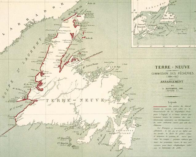
| Keywords: French Shore arrangement, 1885.png en Map drawn for the French department of fisheries Commission des pêcheries c 1885 following an arrangement regarding activities on Newfoundland's French Shore The sections in red are areas where activities and installations that are not related to fishing are tolerated by the French government provided they do not interfere with the treaty rights of French fishermen to fish as well to dry and process their catch anywhere on the shore and cut wood to build their non-permanent fishing installations Ouside the red-marked areas the exclusive fishing rights guaranteed by the Treaty of Utrecht and subsequent treaties remain intact 2013-11-11 09 16 34 http //www escalenautique qc ca/admin/archives/pdf/french 20shore pdf Map drawn for the French department of fisheries 1885-1886 PD-old-100 Uploaded with UploadWizard Cod fishery in Canada Old maps of Newfoundland | ||||