MAKE A MEME
View Large Image
| View Original: | FMIB_49949_Profile_of_the_Ocean_Floor_from_the_southernmost_point_of_Norway,_via_the_Straits_of_Dover,_to_the_10th_degree_of_west_longitude.jpeg (719x465) | |||
| Download: | Original | Medium | Small | Thumb |
| Courtesy of: | commons.wikimedia.org | More Like This | ||
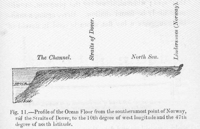
| Keywords: FMIB 49949 Profile of the Ocean Floor from the southernmost point of Norway, via the Straits of Dover, to the 10th degree of west longitude.jpeg check categories 4 September 2015 1 Profile of the Ocean Floor from the southernmost point of Norway via the Straits of Dover to the 10th degree of west longitude and the 47th degree of north Latutude Subject Ocean bottom--Measurement Tag Coasts 1872 Cite book Bottom of the Sea Sonrel Leon New York City NY Scribner Armstrong Co 1872 Fig 11 Creator Leon Sonrel PD-UWASH-FMIB Institution University of Washington FMIB-source accession number 49949 Images from the Freshwater and Marine Image Bank to check Leon Sonrel | ||||