MAKE A MEME
View Large Image
| View Original: | FMIB_48259_Chart_of_Pains_Bay_and_Long_Shoal_region,_including_the_planted_beds_of_Pains_Bay_"A"_"B"_"C"_and_"D"_and_Long_Shoal_Depth_of.jpeg (891x483) | |||
| Download: | Original | Medium | Small | Thumb |
| Courtesy of: | commons.wikimedia.org | More Like This | ||
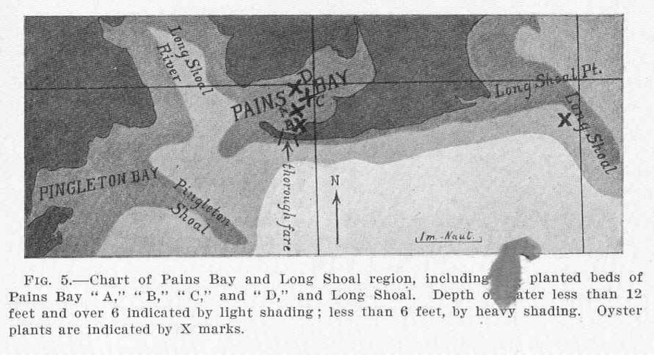
| Keywords: FMIB 48259 Chart of Pains Bay and Long Shoal region, including the planted beds of Pains Bay "A" "B" "C" and "D" and Long Shoal Depth of.jpeg check categories 28 August 2015 2 Chart of Pains Bay and Long Shoal region including the planted beds of Pains Bay A B C and D and Long Shoal Depth of water less than 12 feet and over 6 indicated by light shading; less than 6 feet by heavy shading Oyster plants are indicated by X marks Subject Pains Bay North Carolina --Maps Long Shoal North Carolina --Maps Oyster culture--North Carolina Geographic Subject United States--North Carolina--Pains Bay United States--North Carolina--Long Shoal Tag Shellfish Coasts 1907 Cite book Experiments in Oyster Culture in Pamlico Sound North Carolina Coker Robert E Raleigh NC E M Uzzell Co 1907 Bulletin North Carolina Geological and Economic Survey ; no 15 Fig 5 Creator Robert Ervin Coker PD-UWASH-FMIB Institution University of Washington FMIB-source accession number 48259 Images from the Freshwater and Marine Image Bank to check Robert Ervin Coker Shellfish | ||||