MAKE A MEME
View Large Image
| View Original: | FMIB_45362_Map_of_St_George_Island--Pribylov_Group.jpeg (1490x874) | |||
| Download: | Original | Medium | Small | Thumb |
| Courtesy of: | commons.wikimedia.org | More Like This | ||
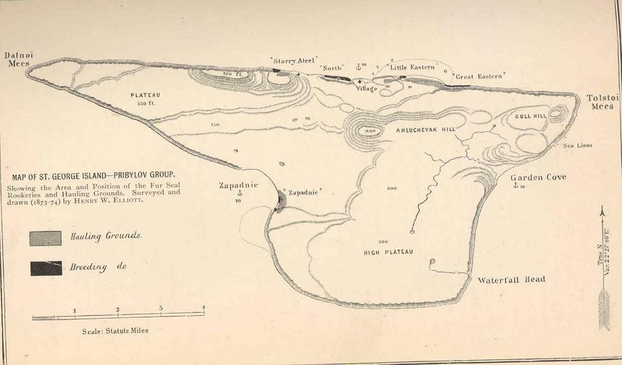
| Keywords: FMIB 45362 Map of St George Island--Pribylov Group.jpeg check categories 23 August 2015 3 Map of St George Island--Pribylov Group Showing the Area and Position of the Fur Seal Rookeries and Hauling Grounds Surveyed and drawn 1873-74 by Henry W Elliott Subject Alaska--Maps Saint George Alaska --Maps Geographic Subject United States--Alaska--Saint George Tag Coasts 1873 1874 1874 Cite book Our Arctic Province Alaska and the Seal Islands Elliott Henry W New York City NY Charles Scribner's Sons 1897 Library of Contemporary Exploration and Adventure Facing page 226 Creator Henry Wood Elliott PD-UWASH-FMIB Institution University of Washington FMIB-source accession number 45362 Images from the Freshwater and Marine Image Bank to check Henry W Elliott Maps of Alaska Saint George Alaska | ||||