MAKE A MEME
View Large Image
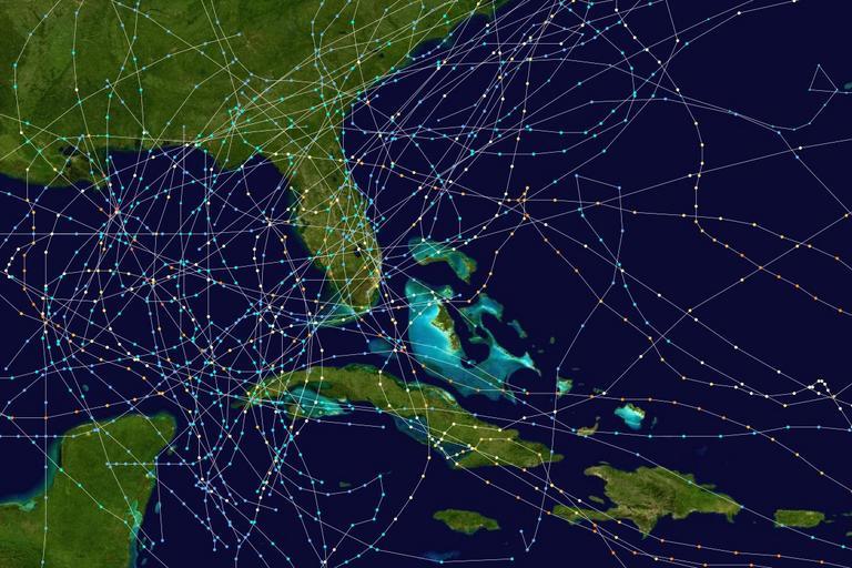
| View Original: | Florida hurricane (1950-1974) tracks.jpg (1200x800) | |||
| Download: | Original | Medium | Small | Thumb |
| Courtesy of: | commons.wikimedia.org | More Like This | ||
| Keywords: Florida hurricane (1950-1974) tracks.jpg This map shows the tracks of all Tropical cyclones from 1950 to 1974 with effects in Florida Uses the color scheme from the Saffir-Simpson Hurricane Scale Created using User jdorje/Tracks Background image from Image Whole world - land and oceans jpg NASA Tracking data from the w National Hurricane Center http //www nhc noaa gov/pastall shtml Cumulative Atlantic hurricane trackmaps Florida | ||||
-tracks.jpg)