MAKE A MEME
View Large Image
| View Original: | FirstMap-ChristmasIsland.jpg (460x452) | |||
| Download: | Original | Medium | Small | Thumb |
| Courtesy of: | commons.wikimedia.org | More Like This | ||
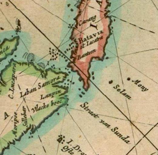
| Keywords: FirstMap-ChristmasIsland.jpg en A part of Dutchman Pieter Goos' map of the East Indies Paskaerte zynde t'oosterdeel van Oost Indien met alle de eylanden deer ontrendt geleegen van C Comorin tot aen Iapan This small section of the map shows the location of Mony now called Christmas Island It is the first time Christmas Island appears on a map Map of the East Indies by Pieter Goos Paskaerte zynde t'oosterdeel van Oost Indien met alle de eylanden deer ontrendt geleegen van C Comorin tot aen Iapan Creator Pieter Goos 1666 Public Domain http //commons wikimedia org/wiki/File MapEastIndian-PieterGoos jpg PD-old-100 Pieter Goos Maps of Christmas Island Maps made in the 17th century | ||||