MAKE A MEME
View Large Image

| View Original: | Enso_normal.png (590x413) | |||
| Download: | Original | Medium | Small | Thumb |
| Courtesy of: | commons.wikimedia.org | More Like This | ||
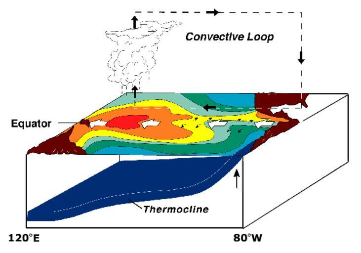
| Keywords: Enso normal.png File ENSO - normal svg it's under PD-USGov-DOC-NOAA EN WP says ENSO normal state Normal equatorial winds warm as they flow westward across the Pacific Cold water is pulled up along west coast of South America Warming water is pushed toward west side of Pacific Sea surface is warm in the west Hot air rises in western Pacific travels eastward and cool air descends on South America ---- Derived from NOAA / PMEL / TAO diagrams http //www pmel noaa gov/tao/proj_over/diagrams/index html PD-USGov derivative works Enso normal-el PNG DEFAULTSORT Circulation normal El Nino La Niña Oceanographic diagrams Climatological diagrams Diagrams in English Sea surface temperature maps | ||||