MAKE A MEME
View Large Image
| View Original: | Engilin1000.JPG (252x197) | |||
| Download: | Original | Medium | Small | Thumb |
| Courtesy of: | commons.wikimedia.org | More Like This | ||
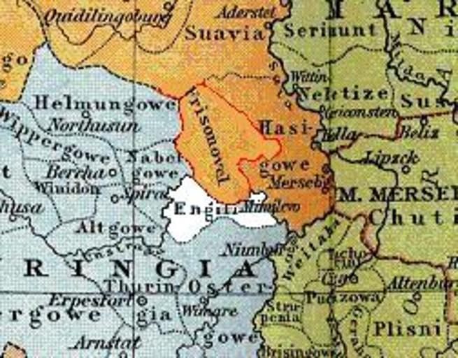
| Keywords: Engilin1000.JPG Lage des Gaus Engilin um 1000 Karte Heiliges Römisches Reich um 1000 Gustav Droysen Allgemeiner historischer Handatlas 1886 <br>thumb left Heiliges Römisches Reich 1000 10 Juli 2011 upload Drekamu Siehe unten PD-old Original upload log de wikipedia Engilin1000 JPG wikitable - 2011-07-10 11 49 252×197× 25033 bytes Drekamu <nowiki> Andere Versionen </nowiki> Old maps of the Holy Roman Empire Maps from Allgemeiner Historischer Handatlas Maps showing 10th-century history | ||||