MAKE A MEME
View Large Image
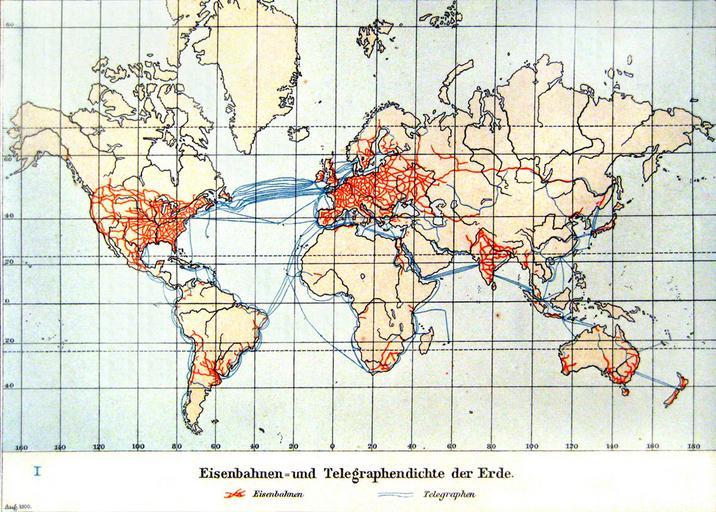
| View Original: | Eisenbahnen-_und_Telegraphendichte_der_Erde_um_1900.jpg (1200x858) | |||
| Download: | Original | Medium | Small | Thumb |
| Courtesy of: | commons.wikimedia.org | More Like This | ||
| Keywords: Eisenbahnen- und Telegraphendichte der Erde um 1900.jpg Eisenbahnen- und Telegraphendichte der Erde um 1900 Kopie aus Andrees Handatlas von 1901 S 17 Kolonial- und Weltverkehrskarte World Map of the Railway and Telegraph Network Density at 1900 Copy from Andrees Handatlas 1901 S 17 Kolonial- und Weltverkehrskarte Andrees Handatlas 4 Auflage 1901 Herausgegeben v Albert Scobel PD-old Rail transport maps Maps of telegraph lines 1900s maps of the world 1901 maps Communications maps of the world Transport maps of the world | ||||