MAKE A MEME
View Large Image
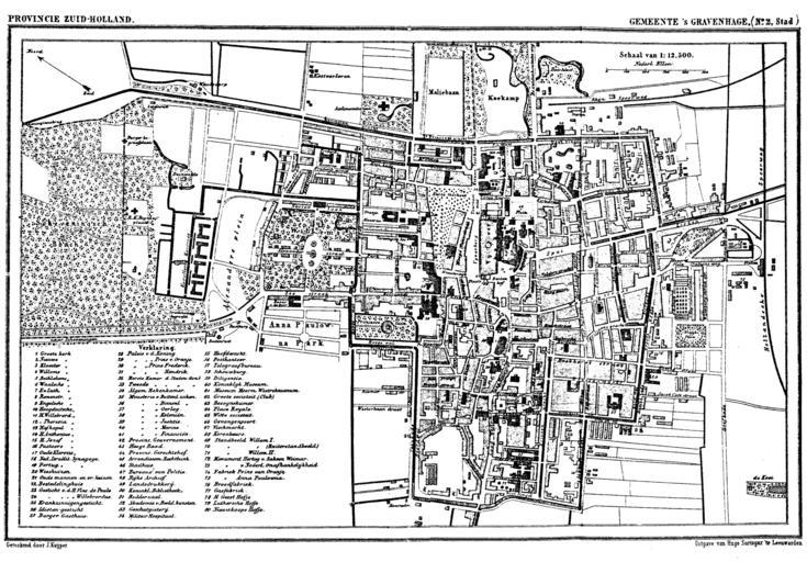
| View Original: | Den_Haag_1868.png (1800x1254) | |||
| Download: | Original | Medium | Small | Thumb |
| Courtesy of: | commons.wikimedia.org | More Like This | ||
| Keywords: Den Haag 1868.png Historic map of The Hague the Netherlands Gemeente Atlas van Nederland Municipal Atlas of the Netherlands 1865-1870 J Kuyper PD-old Old maps of The Hague 1868 Gemeente Atlas van Nederland - South Holland The Hague in the 1860s | ||||