MAKE A MEME
View Large Image
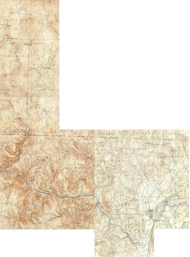
| View Original: | Deerfield_River_map_(Massachusetts_+_Vermont).jpg (5156x6963) | |||
| Download: | Original | Medium | Small | Thumb |
| Courtesy of: | commons.wikimedia.org | More Like This | ||
| Keywords: Deerfield River map (Massachusetts + Vermont).jpg Map of the Deerfield River and environs Vermont and Massachusetts This map was made by stitching together 7 USGS maps of the area; each came from the USGS 15 Minute Series with various dates in the 1890s s 1890 United States Geological Survey US Department of the Interior Public domain - original work of the US Federal Government PD-USGov Deerfield River | ||||
.jpg)