MAKE A MEME
View Large Image

| View Original: | Deception-Island-Map.jpg (1302x2065) | |||
| Download: | Original | Medium | Small | Thumb |
| Courtesy of: | commons.wikimedia.org | More Like This | ||
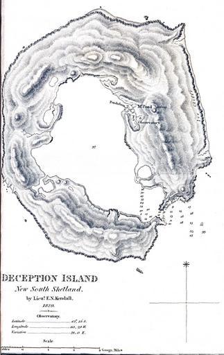
| Keywords: Deception-Island-Map.jpg en Map created on the first scientific expedition to Deception Island in 1829 under the command of captain Henry Foster http //mappery com/fullsize-name/Deception-Island-Map Lieut E N Kendall 1829 PD-old Maps of Deception Island Old maps of Antarctica | ||||