MAKE A MEME
View Large Image
| View Original: | Dead_Man's_Curve,_Sunset_Blvd_at_Evans_Rd,_Los_Angeles.jpg (877x1280) | |||
| Download: | Original | Medium | Small | Thumb |
| Courtesy of: | commons.wikimedia.org | More Like This | ||
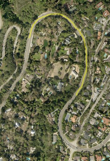
| Keywords: Dead Man's Curve, Sunset Blvd at Evans Rd, Los Angeles.jpg en Blind decreasing radius turn with downhill entry traveling westbound from right to left 2015-08-28 http //egis3 lacounty gov/dataportal/2013/02/28/2011-lar-iac-imagery-public-domain-1-foot-free/ This dataset represents natural color leaf-off 1 foot high-accuracy orthorectified aerial imagery acquired by the Los Angeles Regional Imagery Consortium LAR-IAC in winter 2010/2011 and made public with the partnership of the US Geological Survey USGS other versions 34 051144 -118 510691 heading 270 Actual location of curve immortalized by Jan and Dean in their hit song Dead Man's Curve PD-USGov Uploaded with UploadWizard Pacific Palisades Los Angeles Aerial photographs of Los Angeles 2011 LAR-IAC Imagery | ||||