MAKE A MEME
View Large Image
| View Original: | DCQUADS.jpg (548x697) | |||
| Download: | Original | Medium | Small | Thumb |
| Courtesy of: | commons.wikimedia.org | More Like This | ||
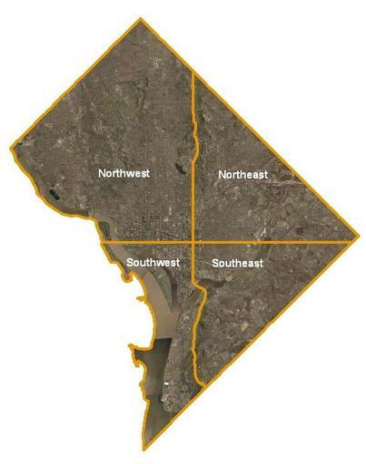
| Keywords: DCQUADS.jpg taken from the english wikipedia original text USGS satellite image of Washington DC taken April 26 2002 The Potomac River and its eastern branch the Anacostia River are visible Virginia lies across the Potomac from Washington while Maryland surrounds it on all other sides The orange lines in the image mark the quadrant divisions of Washington with the U S Capitol at the center of the dividing lines To the west of the Capitol extends the National Mall visible as a slight green band in the image This image is a work of a United States Geological Survey employee taken or made during the course of the person's official duties As a work of the United States Government the image is in the public domain For more information see the USGS copyright policy first publisher en User Djack23 PD-USGov Maps of Washington D C Quadrants of Washington D C | ||||