MAKE A MEME
View Large Image
| View Original: | Dane6271937_5-389_7x9.jpg (2837x2244) | |||
| Download: | Original | Medium | Small | Thumb |
| Courtesy of: | commons.wikimedia.org | More Like This | ||
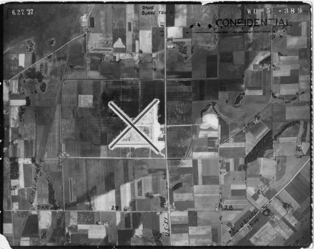
| Keywords: Dane6271937 5-389 7x9.jpg en Madison Municipal Airport and surroundings Madison WI June 1937 Under Construction Dane County Agency USDA Subject Agriculture Roll-Exp 5-389 6/27/1937 Dane6271937_5-389_7x9 Photograph Agency Source Information The source agencies responsible for the original flights are the United States Department of Agriculture USDA and the United States Geological Survey USGS The vast majority of the state was flown by the USDA Only parts of Forest Florence Iron Marinette Oneida and Vilas counties were flown by the USGS Photograph Information Format The original aerial photographs are black and white They measure either a seven inches by nine inches 7 x9 or b nine inches by nine inches 9 x9 Scale All photographs in the 1937-41 series are 1 20 000 or 1 1667 ™ Copyright As works of the United States government all photographs in this collection are in the public domain http //maps sco wisc edu/WHAIFinder/ USDA 1937-06-27 Dane County Regional Airport PD-USGov | ||||