MAKE A MEME
View Large Image
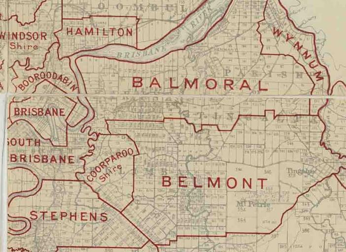
| View Original: | Coorparoo Shire, March 1902.jpg (951x694) | |||
| Download: | Original | Medium | Small | Thumb |
| Courtesy of: | commons.wikimedia.org | More Like This | ||
| Keywords: Coorparoo Shire, March 1902.jpg en Map of Shire of Coorparoo and adjacent local government areas March 1902 2013-10-30 11 53 06 Citation Queensland Survey Office Queensland illustrating Local Authorities Districts 1902 Queensland Survey Office http //trove nla gov au/work/33661272 1 November 2013 available on Commons as File Queensland-Divisions-1902 jpg Queensland Survey Office -27 495 153 060 Crop of File Queensland-Divisions-1902 jpg to focus on Shire of Coorparoo Custom license marker 2014 01 08 PD-Australia Uploaded with UploadWizard Maps of local government areas in Queensland 1902 in Queensland Images from the State Library of Queensland | ||||