MAKE A MEME
View Large Image
| View Original: | Collet_Map_excerpt_Bute_County.jpeg (512x512) | |||
| Download: | Original | Medium | Small | Thumb |
| Courtesy of: | commons.wikimedia.org | More Like This | ||
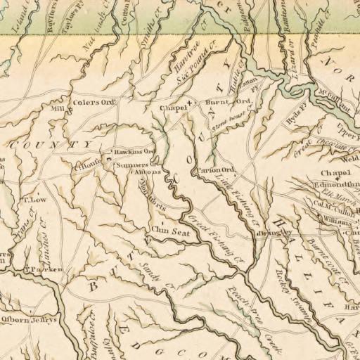
| Keywords: Collet Map excerpt Bute County.jpeg en An excerpt of John Collet's 1770 map of North Carolina depicting several plantations and settlements in Bute County 1770 University of North Carolina Digital Collections http //dc lib unc edu/cdm/ref/collection/ncmaps/id/467 John Collet J Bayly S Hooper other versions PD-old-100-1923 Original upload log page en wikipedia Collet_Map_excerpt_Bute_County jpeg 2013-06-23 14 00 Cdtew 512×512× 67263 bytes <nowiki>Uploading an old public-domain work using File Upload Wizard</nowiki> Uncategorized 2014 December 31 Uploaded with UploadWizard | ||||