MAKE A MEME
View Large Image

| View Original: | ChickasawWars.jpg (490x809) | |||
| Download: | Original | Medium | Small | Thumb |
| Courtesy of: | commons.wikimedia.org | More Like This | ||
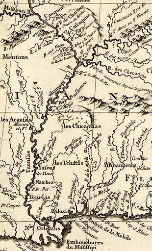
| Keywords: ChickasawWars.jpg Area map of the Chickasaw Wars of 1720 - 1760 French campaigns began from New Orleans and Mobile in the south and Fort de Chartres and Fort Vincennes in the north Fort Prudhomme was a meeting place for d'Artaguette's forces in 1736 and Fort Assumption was the meeting place for all attack forces in 1739 Source Jacques Bellin La Lousiane et Pays Voisins Paris 1764 Library of Congress http //hdl loc gov/loc gmd/g3300 ar011101 Published 1764 Jacques Bellin other versions PD-old PD-old-100 1764 maps Old maps of Louisiana Colonial Louisiana Chickasaw Campaign of 1736 Old maps of New France | ||||