MAKE A MEME
View Large Image
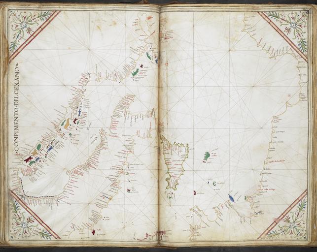
| View Original: | Chart of the western half of the Morea, the Adriatic Sea, Sicily, the western coast of Italy south of the Arno, with the corresponding coast of Africa. Inscribed “Conpimento del Cexano”- Cornaro Atlas (Egerton MS 73, f.25r).jpeg.jpg (8045x6404) | |||
| Download: | Original | Medium | Small | Thumb |
| Courtesy of: | commons.wikimedia.org | More Like This | ||
| Keywords: Chart of the western half of the Morea, the Adriatic Sea, Sicily, the western coast of Italy south of the Arno, with the corresponding coast of Africa. Inscribed “Conpimento del Cexano”- Cornaro Atlas (Egerton MS 73, f.25r).jpeg accession number Chart of the western half of the Morea the Adriatic Sea Sicily the western coast of Italy south of the Arno with the corresponding coast of Africa Inscribed Conpimento del Cexano Institution British Library map date other fields Information field British Library Shelfmark Egerton MS 73 f 25r other versions PD-old print date British Library image 004976836 yes Cornaro Atlas warp status wikidata location wikidata title Uploaded with GWToolset Chart of the western half of the Morea the Adriatic Sea Sicily the western coast of Italy south of the Arno with the corresponding coast of Africa Inscribed Conpimento del Cexano - Cornaro Atlas Egerton MS 73 f 25r http //www webarchive org uk/bldatasets/MapImages/Pelagios/CornaroAtlas/egerton_ms_73_f025r jpeg Collections_of_the_British_Library British_Library_Maps_Collections Cornaro Atlas | ||||
.jpeg.jpg)