MAKE A MEME
View Large Image

| View Original: | Carte-ORTF de.svg (875x686) | |||
| Download: | Original | Medium | Small | Thumb |
| Courtesy of: | commons.wikimedia.org | More Like This | ||
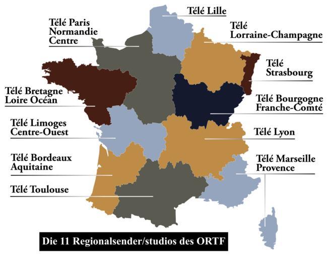
| Keywords: Carte-ORTF de.svg de Karte der regionalen Kanäle des ORTF fr Carte des stations régionales de l'ORTF en Map of regional channels of the ORTF Carte-ORTF svg 50 2012-05-05 19 44 UTC Carte-ORTF svg Daisy0705 derivative work Furfur traduction allemand/deutsche à bersetzung Furfur Carte-ORTF svg Cc-zero Original upload log This image is a derivative work of the following images File Carte-ORTF svg licensed with Cc-zero 2011-10-14T07 06 55Z Daisy0705 846x656 207994 Bytes <nowiki>Je continue à résoudre les erreurs</nowiki> 2011-10-14T07 05 28Z Daisy0705 860x670 186662 Bytes <nowiki>Correction d'erreur</nowiki> 2011-10-14T07 04 57Z Daisy0705 900x700 208209 Bytes <nowiki>Reverted to version as of 07 00 14 October 2011</nowiki> 2011-10-14T07 03 21Z Daisy0705 880x690 212256 Bytes <nowiki>Augmentation contour régions</nowiki> 2011-10-14T07 00 59Z Daisy0705 846x685 212276 Bytes <nowiki>Couleurs pour plus de lisibilité</nowiki> 2011-10-14T07 00 27Z Daisy0705 900x700 208209 Bytes <nowiki>Reverted to version as of 12 12 8 August 2011</nowiki> 2011-10-14T06 58 49Z Daisy0705 846x656 208703 Bytes <nowiki>Correction d'une erreur de typo</nowiki> 2011-10-14T06 57 43Z Daisy0705 846x656 186946 Bytes <nowiki>Ajout de couleurs toujours pour améliorer la lisibilité</nowiki> 2011-08-08T12 12 43Z Daisy0705 900x700 208209 Bytes <nowiki>Agrandissement des limites des régions pour plus de lisibilité</nowiki> 2011-08-08T12 08 11Z Daisy0705 900x700 207985 Bytes <nowiki> en Map of regional channels of the ORTF fr Carte des stations régionales de l'ORTF Création personnelle Daisy0705 08/08/2011 Per</nowiki> Uploaded with derivativeFX Maps of regions of France SVG maps in German Maps of television coverage areas SVG maps of the history of France | ||||