MAKE A MEME
View Large Image
| View Original: | Camps_topographiques_de_la_campagne_de_MDCCLVII,_en_Westphalie,_1757,_07,_24-25,_Plan_No._24._Emmerthal_Frenke_Börry_Bessinghausen_-_detail.jpg (4232x2776) | |||
| Download: | Original | Medium | Small | Thumb |
| Courtesy of: | commons.wikimedia.org | More Like This | ||
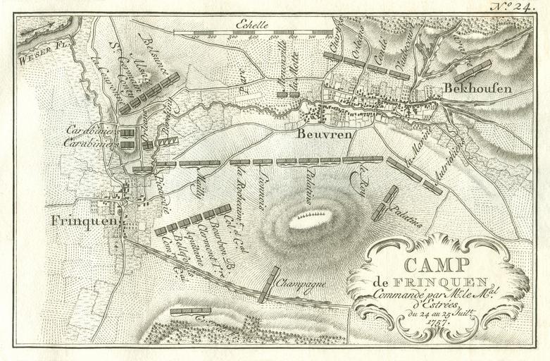
| Keywords: Camps topographiques de la campagne de MDCCLVII, en Westphalie, 1757, 07, 24-25, Plan No. 24. Emmerthal Frenke Börry Bessinghausen - detail.jpg Topographische Karten der Feldlager des Feldzuges von 1757 in Westfalen hier Nr 24 Feldlager Frenke in Niedersachsen mit Börry und Bessinghausen befehligt durch Seine Durchlaucht den Marschall von Estrées ; Kupferstich von Jacobus van der Schley <br /> edited detail-version 0 3 deg rotated; color-adjustments by gimp <brightness +32 contrast +8>; cropped and retouched borders; retouching of some spots and scratches in whitespace with nearby content File Emmerthal Frenke Börry Bessinghausen 1757 jpg Du Bois Camps topographiques de la campagne de 1757 en Westphalie commencée par Mr Le Maréchal d'Estrées continuée par Mr Le Duc de Richelieu finie par Mgr le Comte de Clermont avec le journal de ses operations quelques autres morceaux fort curieux A La Haye Veuve Van Duren 1760 Creator Jacobus van der Schley Edited by user Jaybear 1760 <gallery> Emmerthal Frenke Börry Bessinghausen 1757 jpg Original Image Emmerthal Frenke Börry Bessinghausen 1757 cropped jpg Smaller Detail Image </gallery> PD-old-100 Camps topographiques de la campagne de MDCCLVII en Westphalie Louis Charles César Le Tellier Maps of the Battle of Hastenbeck Emmerthal | ||||