MAKE A MEME
View Large Image
| View Original: | California_US_Congressional_District_2_(since_2013).tif (2016x998) | |||
| Download: | Original | Medium | Small | Thumb |
| Courtesy of: | commons.wikimedia.org | More Like This | ||
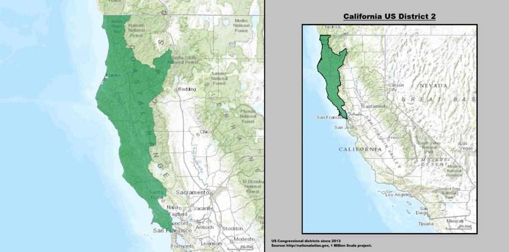
| Keywords: California US Congressional District 2 (since 2013).tif California's 2nd congressional district ” encompassing the northern California coast from the Golden Gate Bridge to the Oregon border It consists of Marin Mendocino Humboldt Del Norte and Trinity counties ” plus portions of western Sonoma County Cities in the district include San Rafael Petaluma Novato Windsor Healdsburg Ukiah Fort Bragg Fortuna Eureka Arcata McKinleyville and Crescent City California 2014-03-21 21 05 26 GIS shapefile data created by the United States Department of the Interior as part of the 1 Million Scale geospatial data project Retrieved from http //nationalatlas gov/atlasftp-1m html openChapters chpbound 1 GIS congressional districts 2013 shapefile data was created by the United States Department of the Interior 2 Data was rendered using ArcGIS® software by Esri 3 File developed for use on Wikipedia and elsewhere by 7partparadigm PD-USGov Uploaded with UploadWizard Congressional district maps of California CA 02 Maps of Del Norte County California Maps of Humboldt County California Maps of Marin County California Maps of Mendocino County California Maps of Sonoma County California Maps of Trinity County California Arcata California ˘ Crescent City California ˘ Fort Bragg California ˘ Healdsburg California ˘ Novato California ˘ Petaluma California ˘ San Rafael California ˘ Ukiah California ˘ en California's 2nd congressional district | ||||