MAKE A MEME
View Large Image
| View Original: | CA-1st.png (660x401) | |||
| Download: | Original | Medium | Small | Thumb |
| Courtesy of: | commons.wikimedia.org | More Like This | ||
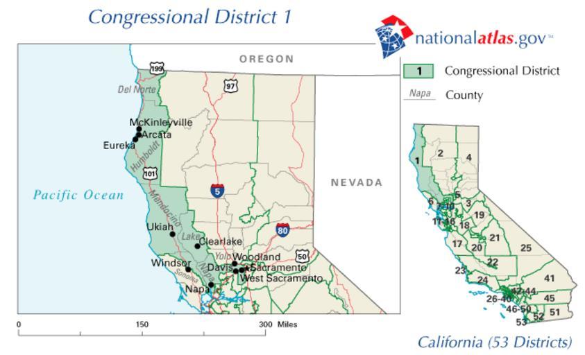
| Keywords: CA-1st.png en Map of former location U S 1st Congressional district in California 2003 to 2013 http //nationalatlas gov/printable/congress html http //nationalatlas gov National Atlas of the United States United States Department of the Interior PD-USGov original upload log page en wikipedia CA-1st gif 2007-02-14 17 55 VitaleBaby 660Ă—401Ă—7 34843 bytes <nowiki>http //nationalatlas gov/printable/congress html PD-USGov </nowiki> Congressional district maps of California ˘Former Maps of Del Norte County California ˘Former Maps of Humboldt County California ˘Former Maps of Lake County California ˘Former Maps of Mendocino County California ˘Former Maps of Napa County California ˘Former Maps of Sonoma County California ˘Former Maps of Yolo County California ˘Former Congressional district maps of the 109th Congress California 01 Original upload log wikitable - - 2008-02-21 10 00 08 660 Ă— 401 34843 bytes Whhalbert <nowiki> http //nationalatlas gov/printable/congress html Transferred from http //en wikipedia org en wikipedia 2007-02-14 original upload date Original uploader was VitaleBaby at </nowiki> | ||||