MAKE A MEME
View Large Image
| View Original: | Bulletin 429 Plate III Anse La Butte Oil Field.jpg (2258x973) | |||
| Download: | Original | Medium | Small | Thumb |
| Courtesy of: | commons.wikimedia.org | More Like This | ||
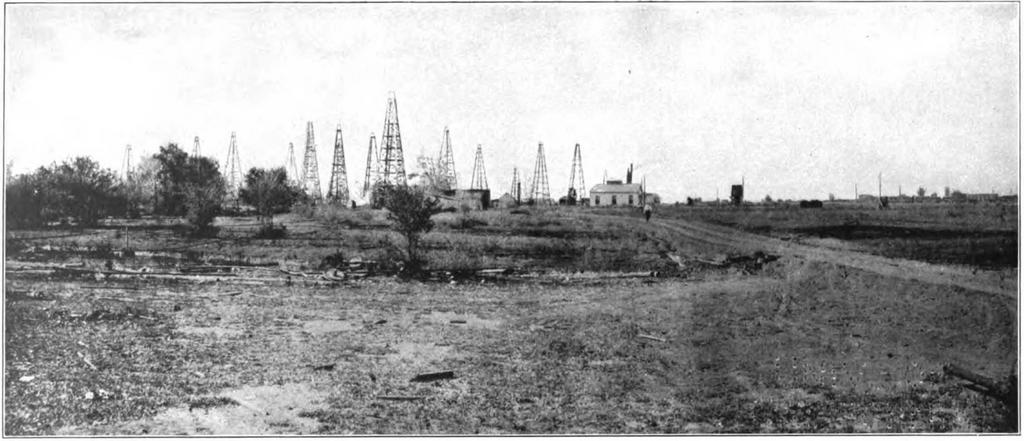
| Keywords: Bulletin 429 Plate III Anse La Butte Oil Field.jpg en Bulletin 429 Plate III original caption <br> Anse La Butte Oil Field looking northwest The swamp underneath which the solid rock-salt dome is located may be seen at the extreme left; the low butte lies immediately beyond hidden by foliage; the curved outline of the depression the cove the anse and the slight elevation the butte gave the field its name Most of the successful wells are located centrally in the group of derricks shown An air plant the Lafayette and Baton Rouge branch of the Southern Pacific Railroad and loading racks can be seen at the right 1910 Oil and Gas in Louisiana with a Brief Summary of their Occurrence in Adjacent States Bulletin 429 United States Geological Survey Government Printing Office Washington 1910 G D Harris other versions PD-USGov Geology Oil | ||||