MAKE A MEME
View Large Image
| View Original: | Brittain_410.jpg (1111x1497) | |||
| Download: | Original | Medium | Small | Thumb |
| Courtesy of: | commons.wikimedia.org | More Like This | ||
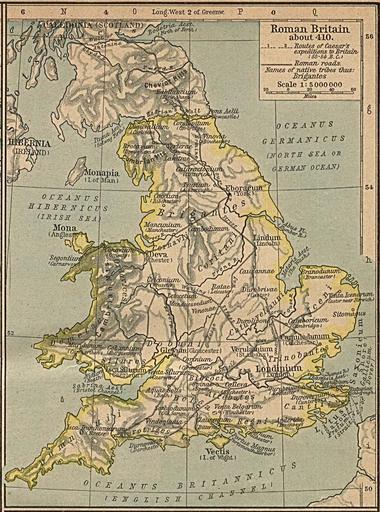
| Keywords: Brittain 410.jpg Map of the isle Great Britain in the year 410 Image comes from the http //www lib utexas edu/maps/historical/history 5Feurope html Historical Maps of Europe at University of Texas at Austin The work is from From The Historical Atlas by William R Shepherd 1926 Map is released into the public Domain PD-old Old maps of Great Britain 1926 Maps of Roman Britain Maps of the history of England Maps of the history of Wales | ||||