MAKE A MEME
View Large Image
| View Original: | BritishWestFlorida1776.jpg (1752x908) | |||
| Download: | Original | Medium | Small | Thumb |
| Courtesy of: | commons.wikimedia.org | More Like This | ||
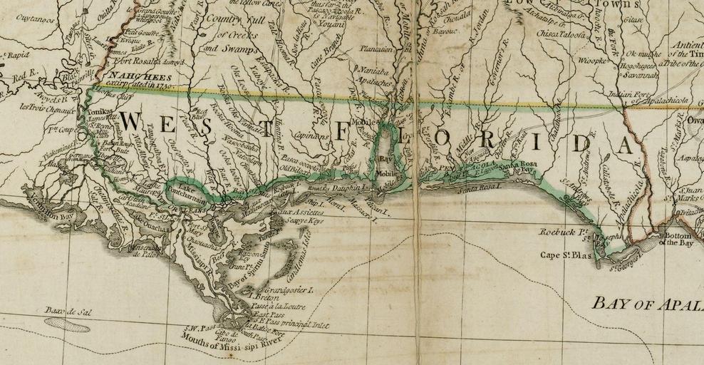
| Keywords: BritishWestFlorida1776.jpg British West Florida roughly including the Gulf Coast between the Mississippi River and the Apalachicola River From the Darlington Digital Library at the University of Pittsburgh identifier DARMAP0298 http //images library pitt edu/cgi-bin/i/image/image-idx med 1;image_search 20btn Go;q1 florida;rgn1 darlmaps_all;sid 9f1d2a0afbb2d02f51e12f6a87a01616;size 20;c darlmaps;lasttype boolean;view entry;lastview thumbnail;subview detail;cc darlmaps;entryid x-darmap0298;viewid DARMAP0298 TIF;start 1;resnum 7 Bernard Romans 1776 PD-old-100 Old maps showing the history of the former colonies of the United Kingdom Old maps of Florida Old maps of Alabama Old maps of Mississippi Old maps of Louisiana | ||||