MAKE A MEME
View Large Image
| View Original: | Borden_Base_Line_-_Massachusetts_map,_1871.jpg (642x670) | |||
| Download: | Original | Medium | Small | Thumb |
| Courtesy of: | commons.wikimedia.org | More Like This | ||
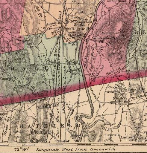
| Keywords: Borden Base Line - Massachusetts map, 1871.jpg Map showing the location of the Borden Base Line running north/south between South Deerfield and Hatfield Massachusetts USA here indicated as the Base Line of the Mass Trigonometrical Survey This was the baseline for the first geodetic survey in the United States This line was surveyed in 1831 to an accuracy of better than 1 part in 5 million by Simeon Borden Official Topographic Map of Massachusetts Philadelphia Stedman Brown Lyon 1871 Page 43 Franklin County This image has been cropped to remove extraneous terrain 1871 H F Walling Ormando Willis Gray Public domain - author died more than 70 years ago PD-old Borden Base Line Old maps of Massachusetts | ||||