MAKE A MEME
View Large Image
| View Original: | Booth Povery Map - Weymouth New Cavendish Streets Extract 1888-9.jpg (556x432) | |||
| Download: | Original | Medium | Small | Thumb |
| Courtesy of: | commons.wikimedia.org | More Like This | ||
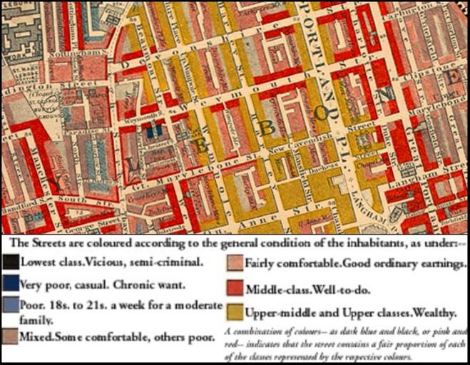
| Keywords: Booth Povery Map - Weymouth New Cavendish Streets Extract 1888-9.jpg en English Map of section of St Marylebone from Charles Booth's Labour and Life of the People The streets are coloured to represent the economic class of the residents 1889-01-02 English Map of section of St Marylebone from Charles Booth's Labour and Life of the People The streets are colored to represent the economic class of the residents Yellow Upper-middle and Upper classes Wealthy red Lower middle class - Well-to-do middle class pink Fairly comfortable good ordinary earnings blue Intermittent or casual earnings and black lowest class occasional labourers street sellers loafers criminals and semi-criminals Charles Booth 1840 “1916 other versions PD-old-70-1923 Marylebone Weymouth Street London New Cavendish Street Charles Booth's Descriptive Map of London Poverty | ||||